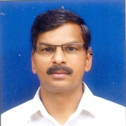
-
Dr Govindaraju .
- Professor
- Kuvempu University
Publications 1998 - 2024
Publications
-
41
Journal Articles
-
23
Conference
Proceedings -
2
Book
-
1
-
1
Citations / H-Index
1
Citations
 3
Citations
Google Scholar

Personal Information
Dr Govindaraju .
Male
Department of Applied Geology, Kuvempu Uniiverrsity, Shankaragata, Karnataka, India
Shimoga, Karnataka, India - 577451
Doctoral Theses Guided
2020
Petrology, Geochemistry and Fluid Inclusion Studies of Pegmatites of Holenarasipura and Karighatta Schist Belts of Karntaka, India of
Somesha G S, Kuvempu University
2020
Micr level Land and Water resource Development plan for Koranahalli Subwatershed in Tarikere Taluk, Chikmagaluru District. Using Remote Sensing and GIS techiniques
Ravikumar D, Kuvempu University
2017
Flood hazard Assessment ,Zonation and Change detection using GIS,GPSand Multi Temporal remote sensing Data-A case study of part of Tungabhadra and Hgari river Subcatchment, North east Karntaka, India
LINGADEVARU d c, Kuvempu University
2020
Petrology, Geochemistry and Fluid Inclusion Studies of Pegmatites of Holenarasipura and Karighatta Schist Belts of Karntaka, India of
Somesha G S, Kuvempu University
2020
Micr level Land and Water resource Development plan for Koranahalli Subwatershed in Tarikere Taluk, Chikmagaluru District. Using Remote Sensing and GIS techiniques
Ravikumar D, Kuvempu University
2017
Flood hazard Assessment ,Zonation and Change detection using GIS,GPSand Multi Temporal remote sensing Data-A case study of part of Tungabhadra and Hgari river Subcatchment, North east Karntaka, India
LINGADEVARU d c, Kuvempu University
2016
Reservoir induced land use land cover changes and creation of simulation model to estimate submergence of land in the catchment of upper tunga project in Shimoga district, Karnataka ,using remote sensing, GIS and GPS
Jayakumar P D, Kuvempu University


